Where there’s water

IMG_7171
There has been human activity around the village of Thixendale since prehistoric times

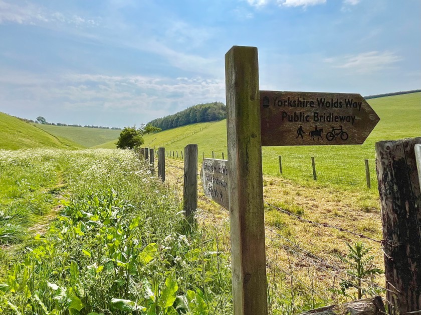
I mentioned the lovely village of Thixendale in my recent column about the Yorkshire Wolds. I had already decided that I would do another piece focussing on that specific village because it has such a rich history. As I was researching, I also came across the mention of the ancient ridge and furrow method of farming, which was also the subject of an earlier column. I’ll have to get back on to those rolling Wolds to see if I can spot the signs for myself!

There has been evidence of activity around the village since the Mesolithic and the Neolithic periods (Middle Stone Age, 7,000-10,000 years ago and New Stone Age, 5,000-7,000 years ago) as shown by the discovery of man-made prehistoric tools such as flints (a sharp stone blade) and scrapers for animal skins. Much of the Stone Age coincided with the Pleistocene Epoch (the last era of the various Ice Ages), and as a result of the frozen ground, early humans lived a nomadic lifestyle, only staying in Thixendale for part of the year until they were driven on by the continuous search for food. The hunter-gatherer diet would have been mainly meat and foraged berries and seeds

It is the two-million-year-long Pleistocene Epoch that is responsible for the topography of the  landscape we see today. The valley in which Thixendale sits would have been created by the run-off from glaciers creating channels though the chalky surface at the end of the Ice Age. The dramatic fluctuations in climate, from greenhouse-hot to freezer-cold, led to the extinction of many large mammals such as mammoths, sabre-toothed cats and giant ground-sloths. This mass-extinction event marked the end of the Pleistocene Epoch and the beginning of the Holocene Epoch which is where we are today.

The advent of the Bronze Age (about 2,500-800BC) led humans to becoming more settled, when the development of stronger and more sophisticated metal tools enabled people to cultivate the land. There have been a number of Bronze Age barrows (burial mounds) found around Thixendale and nearby dales containing bones and ashes of long-dead inhabitants, alongside food vessels, arrowheads and tools. As time went on, these settled areas became more civilised, and a thriving community established itself in and around Thixendale. We know, from excavations at the nearby deserted mediaeval village of Wharram Percy, that there were formal houses built from around 100BC onwards. Many of the routes and tracks linking the various settlements were forged during the Roman period (from AD43 to 410AD) and more established townships evolved from the 10th century onwards. From the air, evidence of the medieval ridge and furrow agriculture can still be seen, which is where individuals owned several strips of land which they would cultivate to grow vegetable and cereals.

The Enclosure Acts (a series of Acts of Parliament starting in the early 17th century that chopped up and enclosed vast swathes of land that used to be common) put an end to much of that, and most of the land was grabbed by the nearby abbeys of St Mary’s in York, and Kirkham Priory a few miles away. They turned much of the land over to sheep grazing, leaving the residents with very little to live on, and it ultimately led to the desertion of some villages, including Wharram Percy. Thixendale would likely have met the same fate had it not been for good old Henry VIII destroying the Catholic monasteries, nabbing the land and then selling it off to the local aristocracy. The Sykes family of the Sledmere Estate bought the village and the surrounding land and established several thriving farms. In the 19th century, Sir Tatton Sykes did much to improve the lot of Thixendale residents, including providing jobs on the various farms, building a school and a also church, which saved the villagers a strenuous four-mile trek to the one at Wharram Percy.

For obvious reasons, settlements establish themselves around a natural source of water for the simple reason that humans cannot survive without it. However, what intrigues me is the fact I’m not aware of a natural water source in Thixendale. As I mentioned in my last column about the Wolds, the valleys in the area are dry due to the well-draining chalky soil.

How did the people of Thixendale get their water in the very beginning I wonder? I’m sure there is someone out there who will enlighten me.

Read more at countrymansdaughter.com. Follow me on Twitter @countrymansdaug

This column appeared in the Darlington and Stockton Times on 4th and Ryedale Gazette and Herald on 2nd August 2023

A wold of difference

IMG_7563
The Yorkshire Wolds seem to play bridesmaid to the more popular Moors and Dales.
IMG_7176
The sweeping valleys of the Yorkshire Wolds were created by the run-off from glaciers.
IMG_7558
The dales have smooth steep sides, but are completely dry due to the quick-draining chalky soil

I have said this before, but I’m not going to apologise for repeating that here in North Yorkshire we are blessed to have outstanding countryside on our doorstep. When you hear visitors from more urbanised areas eulogising about it, it does make you grateful to be able to experience it every day.

What is so special is that within our border, we have two national parks in the Yorkshire Dales and the North York Moors, as well as two areas of outstanding natural beauty (AONB) in the Howardian Hills and Nidderdale.

But what I want to know is why do the Yorkshire Wolds seem to play bridesmaid the two brides of the Moors and Dales? I’ve recently been spending a bit more time exploring this part of the world and in my opinion, it is equally as stunning, and yet very different, to other parts of North Yorkshire.

Famously, artist David Hockney has a studio in Bridlington where he has worked on some enormous pieces of Wolds-themed art. He describes painting in the winter near Warter, a village between Pocklington and Driffield:

“There was far more colour than I expected. Occasionally a farmer would come and talk to me. They didn’t think I exaggerated the colour. They thought my paintings were very accurate, and talking to them I noticed that they knew just how beautiful it is here.”

Of course, North Yorkshire cannot lay claim to all of the Wolds, much of which do lie in the East Riding, but the part I was visiting recently was around the gorgeous village of Thixendale and the abandoned mediaeval settlement of Wharram Percy, all of which falls within the border of our county. The landscape is markedly different to the areas with which I am familiar, with no heather or bracken cloaking the gently undulating hills and dales, but rather crops and grazing meadows, which give you a clue to the type of agriculture that prevails.

The word ‘wold’ derives from the old German word ‘wald’, and originally referred to forested land, later coming to mean ‘upland forest’ then, once the forest had disappeared, grew simply to refer to upland areas in general. The Yorkshire Wolds are the most northerly chalk hills in the UK, and stretch from the bank of the River Humber near Hessle, curving north and east in a wide boomerang shape, ending up at the stretch of coast between Filey and Bridlington. The characteristics of the geology can clearly be seen in the sheer white cliffs at places like Flamborough Head and Bempton.

The chalky nature of the ground is evident as you trek among the rolling hills, with white pebbles scattered across the earth like never-melting hailstones. What truly sets this apart from other areas of North Yorkshire is the appearance of the dales. The steep-sided green valleys slice acutely into the landscape, barely visible from the tops of the hills. The sides are so smooth and neat that they look almost man-made, as if they’ve been cut by a giant cake slice. Unusually, the valleys have no rivers or streams running through them. The chalk was formed from marine limestone and deposited during the Upper Cretaceous period between 80 – 100 million years ago, with the dales being formed at the end of the ice age, around 18,000 years ago, when melting glaciers led to fast-flowing streams coursing across frozen ground, ultimately creating deep channels in the surface of the land. The chalky ground meant water easily drained away, and so the resulting valleys that we see today remain dry.

In contrast to the Moors and Dales, the way the land is farmed is topsy-turvy, with crops like oil-seed rape, wheat and barley being grown across the tops of the hills, while sheep and cattle graze the valleys.

There is plenty of evidence that the land has been occupied since prehistoric times, and perhaps one of the most famous and impressive locations is that of Wharram Percy, a settlement that at its peak in the 14th century was home to around 200 people spread across 40 or so dwellings, including a number of Viking-style longhouses, the footprints of which can still be seen on the ground.

There is an application ongoing for the Yorkshire Wolds to be declared an Area of Outstanding Natural Beauty, and I do hope they achieve it. Having walked there a few times now, they surely deserve that accolade.

Read more at countrymansdaughter.com. Follow me on Twitter @countrymansdaug

This column appeared in the Darlington and Stockton Times on 28th July and Ryedale Gazette and Herald on 26th July 2023