We are getting stoned again

The photograph sent to me by Peter Sotheran of a horse with cart on Lythe Bank out of Sandsend. It was taken between 1905 and 1907 and a copy of it is held at the Teesside Archive, accessed via the Dorman Museum in Middlesbrough

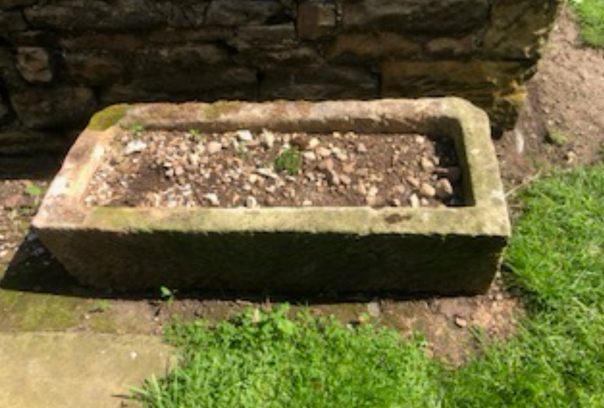
A couple of weeks back, along the continuing theme of troughs and boundary stones, I asked what the holes in the bottom of a carved stone that I found on one of my local walks might be. Once again, a kind reader has jumped to the rescue.

John Buckworth explains: “Hi Sarah. The holes in your stone are probably lifting holes, or dimples, on each side to which they attached a lewis.”

I had no idea what a lewis was and had to look it up, which is no effort for me because I love learning new stuff! For those of you as ignorant as me, a lewis is a device used by stonemasons to lift heavy blocks of masonry and is fitted into pre-drilled holes to evenly distribute the weight of the block, allowing safe and accurate movement from one place to another. John explains: “It has a scissor action, and the curved points stick into the holes and the block and tackle tightens them whilst being lifted. Some of these holes can be on buildings and railway bridges. However, most are concealed because they are covered by the adjacent block. I am still enjoying your articles thank you. Tek care lass.”

Incidentally, I was furnished with even more knowledge that I did not previously possess, namely that the term ‘Lewis’ is also used in the mysterious world of freemasonry. This essential tool symbolises strength and the ability to lift weighty burdens. A freemason’s son is known as a ’Lewis’ because he is meant to support his father and the brotherhood in whatever ways are deemed necessary.

Another reader, Peter Sotheran, also contacted me with a very interesting stone-related story.

“Your paragraphs on moving large blocks of sandstone brought to mind Canon Atkinson, author of ‘Forty Years in a Moorland Parish’.

“After serving as Curate at St. Mary’s Church in Scarborough, Atkinson was appointed Vicar of Danby where he served for 50 years. In his ‘Forty Years’ book Atkinson describes the two-day journey on horseback from Scarborough to Danby. After breaking his journey with an overnight stay in Whitby, Atkinson describes the second leg to Danby.

‘I was told I should find but few on the road I was to pursue, and I might not see a passenger or traveller for miles and miles together. Nor did I.

‘Then the solitude of my way was broken. I was no longer the sole traveller on this rugged lonely roadway; for here I encountered a cavalcade such as I had never before imagined…I met a stone-wagon with a team of no less than twenty horses and oxen, half of either kind. They were drawing a huge block of freestone up the terribly steep bank.’ “

Peter adds: “From other clues in his ‘Forty Years’ book, this would appear to be Lythe Bank, leading up from Sandsend. Atkinson continues:

‘At the foot of the bank were standing four other wagons similarly loaded. The full complement of animals dragging each ponderous load – five tons’ weight on average – in succession to the top; and then, when all were up, the cavalcade re-assembled and proceeded on its slow march again.’ ”

If any of you have ever walked up that notoriously steep bank out of Sandsend, as I have VERY slowly with very little in the way of a heavy load, you will be able to understand just how difficult it must have been to get the horses and oxen and their huge boulders up. I can’t help but feel sorry for the poor animals! Peter sent me a copy of a lovely old postcard of a horse and cart labouring up the hill, which I have included with this article. Peter says: “The picture of the cart and single horse is not from Atkinson’s book. It was a postcard that I picked up in Whitby some years ago. Unfortunately, Atkinson does not mention where the stones are from or where they are destined for.”

Peter told me that over the years he amassed a collection of more than 2500 old local pictures and postcards which he donated to the Teesside Archive, accessed via the Dorman Museum in Middlesbrough, from where this picture comes. It was taken between 1905 and 1909 by a chap called Tom Watson.

I wonder here the stones will lead us next?

Do you have opinions, memories or ideas to share with me? Get in touch with me using the ‘Contact’ button on the top right.

This column appeared in the Darlington & Stockton Times on Friday 11th and the Ryedale Gazette and Herald on Wednesday 9th July  2025

Do you know your boundaries?

The second carved stone that is on my regular walking route. Are these drilled holes marking where it was meant to be split, as described by Andy Brown? Could it be a boundary marker, as suggested by Beryl Richardson?
Mike Broadley’s stone trough that has been in his garden for more than 70 years

When I first started writing about stone troughs back in April I had no idea that these seemingly overlooked lumps of rock would lead to so many memories and stories coming in from readers, some of you with direct knowledge of the history and processes involved in making them.

Andy Brown got in touch with the following: “Early in my career I was taught how to cut large sandstone blocks for building work by the stonemason at Shipley Quarries near Barnard Castle. Sandstone is known as a freestone as it can (fairly) easily be split and shaped both along and across its bedding plane (the layers in which sedimentary rocks are deposited). Small blocks can be split using hammers and chisels by chasing a groove all around where you intend to split the stone and gradually widening this out into a crack. Feathers and wedges are used to split larger blocks by hammering them into a series of holes drilled along where the block is to be split. The blocks are then further worked with hammer and chisel into the desired shape and finish.”

Feathers and wedges are tools used to help shape and split stones. A recent trough-related column of mine mentioned a carved stone that I passed regularly but to which I had previously paid no attention. It was about two and a half feet long, one and a half wide and about a foot deep, but the basin part (if indeed it had been intended to be a trough) had not been hollowed out. It seemed too big to have been a stone intended for a building, so I wondered how it got there, when was it placed there and why was it left unfinished.

Andy answers the question as to how it may have been transported: “Skilled quarrymen and masons could ‘walk’ sizeable stone blocks by pivoting them on their point of balance, but for large blocks, rollers or sledges would be used to transport short distances. For transporting longer distances both fixed and portable windlasses (winches) would be used to load and offload large blocks into sturdy carts…I imagine your trough is a drinking trough for cattle or horses and would be filled by bucket or positioned by a pump.”

Mike Broadley has had a stone trough in his garden for as long as he can remember: “On reading your column about stone troughs I thought I would tell you about one in our front garden. It is still in situ, and I have been here for 70 years. It was fed by a hand pump from a well under the lawn. The pump has long gone but the lead pipe that supplied it is still present, sealed off at ground level. The well is one of a chain linking the houses either side of us in High Ellington village and I think they date back to the time before water mains…I can remember the pump being used when the mains were off.”

Beryl Richardson had another theory about my stone: “The measurements suggest it could be part of an ancient gate post or boundary marker. Some similar to this are on the North York Moors and relate to the boundaries between landowners’ estates. Each stone mason would have their own ‘signature’ marking. My late father from Loftus spent many days looking for these boundary stones which he then included in his local history talks to various groups and students…My dad’s name was John Robert Verrill Carter but was known by everyone as Bob Carter. He was a friend of Tom Leonard who started the museum at Skinningrove and he also knew your father’s column’s predecessor Major Jack Fairfax Blakeborough.”

Beryls’ comments prompted me to return to the stone to see if I could spot a signature, but it was covered with ivy and I couldn’t make anything out. What I did spot, though, was another stone nearby, slightly hidden by a tree. It was smaller and had holes drilled into it, possibly indicating a line along which the intention was to split it (as described by Andy above). Maybe Beryl is right and these stones were deliberately placed there many moons ago to mark the boundary of a local estate now long gone.

I wonder if we will ever know?

Do you have opinions, memories or ideas to share with me? Get in touch with me using the ‘Contact’ button on the top right.

This column appeared in the Darlington & Stockton Times on Friday 27th and the Ryedale Gazette and Herald on Wednesday 25th June 2025